


GPS/GNSS Systems
-
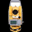
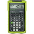
GeoMax Zenith06 GNSS Receiver
GeomaxOriginal price List Price: $4,300.00You Save: $860.00Original price $4,300.00 - Original price $4,300.00Original price List Price: $4,300.00Current price $3,440.00$3,440.00 - $3,440.00Current price $3,440.00- 184 channels for reliable satellite tracking
- Multi-constellation support (GPS, Glonass, Galileo, Beidou, QZSS, SBAS)
- Lightweight at only 0.7 lb
- Works with X-PAD Ultimate field software
- Convenient data management with cloud-based X-PAD 365
- Fast connection with QR scanning functionality
- IP67 dustproof and water-resistant rating
- Long-lasting 20-hour battery life
Original price List Price: $4,300.00You Save: $860.00Original price $4,300.00 - Original price $4,300.00Original price List Price: $4,300.00Current price $3,440.00$3,440.00 - $3,440.00Current price $3,440.00Sold out

GPS/GNSS System Buyer's Guide

In today’s fast-paced construction industry, accuracy and efficiency are critical to staying on schedule and within budget. That’s where GNSS (Global Navigation Satellite System) technology comes in. By enabling construction surveyors to measure, stake out, and verify positions with centimeter-level accuracy, GNSS systems have become essential on today’s jobsites.
Unlike traditional surveying tools that rely on optical line-of-sight, GNSS receivers work with satellite signals to deliver real-time or post-processed coordinates — no need to move reference points or battle obstructions manually.
Whether you're investing in your first GNSS receiver or replacing an aging rover or upgrading to a more advanced setup, this guide is designed to help you evaluate, choose, and deploy the right GNSS system.
What is a GNSS System?
GNSS stands for Global Navigation Satellite System, which refers to any satellite-based positioning technology that determines location anywhere on Earth. While GPS (Global Positioning System) is the U.S. version, GNSS includes multiple constellations like GLONASS (Russia), Galileo (Europe), and BeiDou (China).
Modern GNSS receivers often track signals from multiple constellations simultaneously, improving accuracy and reliability in tough environments such as around buildings, under tree cover, or near heavy equipment. Few of the well-known brands are Stonex and Geomax.
Key Components of GNSS System
- GNSS Receiver (Rover): Captures satellite signals and calculates position data in real time.
- GNSS Antenna: Receives GNSS signals from satellites and delivers them to the receiver. The antenna could be internal or external.
- Base Station (for RTK setups): A stationary GNSS receiver that sends correction data to the rover to improve positioning accuracy.
- Data Collector/Controller: A rugged handheld device or tablet used to view and manage point collection in the field.
- Communication Link (UHF or NTRIP): Enables data transfer between the base receiver and rover.
- Software: Layout and mapping software that processes field data and integrates it with design files.
Types of GNSS System
GNSS can be used in different ways depending on the level of accuracy required, the project size and how fast results are required. In construction surveying, the three most common GNSS methods are autnomous, static and RTK.
- Autonomous GNSS (standalone): This is the simplest form of GNSS use – a single GNSS receiver determines its position using satellite signals without any correction data. It is fast but accuracy is limited.
- Static GNSS: In this mode, two GNSS receivers collect satellite data over several hours. The data is later processed using a software to correct errors and achieve millimeter-accuracy.
- Real-Time Kinematic (RTK) GNSS: The main difference between static and RTK GNSS is RTK processes data in real-time to achieve centimeter-accuracy.
- Post-Processed Kinematic (PPK) GNSS: Similar to static GNSS, PPK GNSS allows surveyors to collect data in the field without a real-time connection. Reference data is used to correct errors.
| GNSS Type | Accuracy | Base Required? | Rover Required? | Real-time? | Best For? |
| Autonomous (standalone) | 1-3 Meters | No | Yes | Yes | Navigation, Rough Positioning |
| Static GNSS | Millimeter | Yes | Yes | No | Control Point Establishment |
| RTK GNSS | 1-2 Centimeter | Yes | Yes | Yes | Construction Layout, Elevation Checks |
| PPK GNSS | 1-2 Centimeter | Yes | Yes | No | Remote/Offline Survey and Documentation |
What is RTK GNSS?
RTK stands for Real-Time Kinematic - a GNSS positioning technique that delivers centimeter-level accuracy by using a base and rover setup.
In a typical RTK workflow:
- A base station and a rover are used to collect satellite data at the same time.
- The base station is set up over a known a point and the rover moves around the site.
- The base calculates the positioning errors and transmits correction data to the rover (via UHF radio or Internet).
- The rover applies corrections in real-time giving accurate coordinates.
Equipment Required for RTK GNSS Setup
To run a fully functional RTK GNSS system, you'll need:
- Base Receiver
- Rover Receiver
- Communication Link to transfer corrections via UHF or NTRIP
- Tripod and Rover Rod to mount both base and rover
- Data collector/controller to view manage points, lines and field data
- GNSS field software for layout, staking and job site control
- Batteries & Chargers to power GNSS receivers for extended field use
For tough terrains, we recommend buying a GNSS receiver with tilt compensation, so you take measurements even when the pole isn't perfectly vertical.
Tiger Supplies offers GNSS system packages designed specifically for construction surveying. These kits include all the essentials (pre-configured) - ready to deploy out of the box.
Common Construction Applications of RTK GNSS
Site Layout and Staking
RTK GNSS systems allow surveyors to quickly stake out building corners, utility lines, road centerlines and grade elevations. They eliminate the need for string lines, tapes, and repeated station setups.
Tools/Accessories Required: RTK GNSS base and rover, Tripod and tribrach (for base), Survey pole with bipod (for rover), UHF radio or NTRIP correction method, Controller with layout software, Stakes, paint, hammer
Utility Mapping and Excavation
Contractors use GNSS to map underground utilities before trenching and to guide excavation depths for water, sewer, or conduit runs. When paired with utility locators, this workflow reduces risk and improves coordination.
Tools/Accessories Required: RTK rover with IMU (for tight areas), Utility locator (GPR or EM), Mapping software + controller, GNSS antenna bracket, Flagging tape, stake flags, spray paint, Tape measure or depth rod
Grading and Elevation Verification
RTK GNSS can quickly verify finished grades, slopes, and elevation differences with real-time cut/fill readings that reduce rework. This is especially useful for foundation prep, road subgrade and drainage features.
Tools/Accessories Required: GNSS rover with tilt compensation, Grade rod or leveling rod, Base station or NTRIP correction source, Layout or elevation-checking software, Benchmark references, stakes
Control Point Establishment
Setting project control is essential for long-term layout consistency. GNSS lets you establish reference points quickly, even on remote or unprepared sites.
Tools/Accessories Required: Base + Rover RTK system with static logging, Tribrach with optical plummet, Long-range UHF radio (if needed), Field software with site calibration support, Control point nails, markers, field notebook
While total stations and lasers are helpful for indoor jobs or where line of sight is required; GNSS systems are the go-to solution for outdoor construction surveying.
Key Features to Consider in a GNSS System
Depending on your job, workflow and budget, not every feature matters equally. Below are the key specifications to look for when comparing GNSS systems.
Accuracy
There are two types of accuracy to look for when buying a GNSS system: RTK Accuracy and Static/PPK accuracy. Real-time correction accuracy is ideal for layout, stakeout and checking elevations. Static/PPK accuracy is for situations where real-time correction is not possible. Accuracy is higher but it takes time to process. Benchmark's BM900 and BM080+ offer static and RTK accuracies.
Tilt Compensation
Tilt Compensation is a must-have for uneven construction sites. A built-in IMU (Inertial Measurement Unit) detects the angle of the pole and automatically corrects the position of the receiver.
Look for “calibration-free IMU support” when buying a receiver with tilt compensation. Benchmark BM850+ and Geomax Zenith60 come with built-in tilt compensation and is activated by default.
Multi-Constellation Support
The more satellite systems your receiver can access, the more reliable your corrections will be, especially in high-interference zone. Some receivers even allow users to prioritize constellations or auto-switch them based on condition.
Channel Count
A “channel” is a signal-processing path for a satellite. The more channels a receiver has, the more signals it can track simultaneously.
While you don’t necessarily need the highest number, anything below 300 channels may restrict you if you are working in urban, hilly or forested areas.
Communication Options
How the base station and rover “talk” to each other impacts the workflow speed and reliability.
- UHF Radio (400-470 MHz): Ideal for remote areas or private job sites. Does not rely on cell coverage.
- NTRIP via Cellular Modem: Ideal for urban environments. Requires a data plan and login credentials.
- Bluetooth/Wi-Fi/USB: Used to connect receivers to data collectors, softwares or transfer files.
We recommend looking for GNSS systems that support both UHF and cellular-based corrections for flexibility.
Battery Life
While 8-12 hours of field runtime is sufficient, if you plan to work for extended hours then look for GNSS systems that offer hot-swappable battery, smart battery management tools or separate charging docks. Benchmark BM980+ has 15 hours operating time and BM900+ comes with 2 hot-swappable batteries.
IP Rating
IP ratings indicate dust and water resistance. IP67 offers dust-tight and waterproof upto 1m depth for 30 minutes. IP68 is better for submerged use and high-pressure sprays.
In addition, shock/vibration resistance as well as operating temperature must be considered when looking to buy a GNSS system.
How to Choose the Right GNSS System
Not every GNSS receiver is right for every job. Your ideal setup depends on how often you're using it, what kind of work you do, work environment and budget.
Task at-hand?
| Task | Feature/s to consider |
| General Construction Layout | RTK (w/ centimeter accuracy), Tilt compensation, UHF radio/NTRIP support |
| Utility Stakeout and Mapping | IMU |
| Excavation and Grading Checks | Integrated controller, Long battery life |
| Control Point Establishment | RTK, PPK |
Work Environment
| Jobsite Type | Features to consider |
| Urban/City | Multi-Constellation, IMU, NTRIP |
| Remote/Rural | UHF, Base and Rover setup |
| Forest/Obstructed | High channel count, IMU, Dual-Frequency Receiver |
| Wide Open Spaces | Long battery life, Base station with high transmit power |
Additional Accessories/Add-Ons Required
A GNSS receiver is the core of your system but it’s not the only thing that matters. The right accessories complete your workflow and keeps you efficient.
Must-have accessories
- Tripod and Tribrach (for base setup)
- Survey pole or rover rod (carbon fiber preferred)
- Bipod (for solo layout or staking)
- Field controller with layout software
- Extra batteries, charger or external power bank
- UHF radio or NTRIP modem (depending on the correction method)
- Carrying case or backpack for field transport
Optional Accessories
- GNSS software licenses for advanced features (e.g. PPK, COGO)
- Survey nails, markers, control caps
- Tilt-enabled pole brackets or antenna mounts
- External antenna (for signal-challenged areas)
- Tribrach with Optical Plummet
Browse our selection of GNSS accessories to find compatible gear for your system or contact us to check compatibility with what you already have.
Tiger Supplies' GNSS Surveying Packages Recommendations
At Tiger Supplies, we offer pre-configured GNSS packages designed specifically for construction surveyors - with options to suit first-time buyers, growing teams, and advanced field professionals. These packages are tested, dependable, and ready to deploy out of the box.
Benchmark BM850 Base and Rover Surveying Package
Ideal for: GNSS users and construction surveyors looking for a basic, budget-friendly RTK GNSS solution for layout, staking and site prep.
Key Specifications
- RTK accuracy: 8mm + 1ppm RMS (Horizontal); 15mm + 1ppm RMS (vertical)
- 1408 Channels with Multi-Constellation support
- 2w radio with 410-470Mhz
- IP67 build to ensure upto 2m pole drop
- IMU integrated
- Up to 10 hours battery life
View BM850 Base and Rover Package details
Benchmark BM900 Base and Rover Surveying Package
Ideal for: Surveyors who need a long-lasting, all-weather GNSS system with extended field time and robust signal performance in challenging environments.
Key Specifications
- Offers static and RTK accuracy
- 1408 Channels with Multi-Constellation support
- 2 Hot-Swappable batteries with upto 12 hours operating time
- IP67/68 build with shock resistance and vibration resistance
View BM900 Base and Rover Package details
Benchmark BM999/BM980 Base and Rover Surveying Package
Ideal for: Surveyors looking for fully-featured GNSS receivers with advanced field capabilities like tilt, dual-frequency communication and camera based data structure.
Key Specifications
- BM980+ is configured as a base station and BM999 as rover
- BM999 offers dual-frequency radio
- BM999 is the only GNSS receiver with built-in dual cameras
- BM999 is IP68 with shock-resistance
- BM980+ offers static and RTK accuracy
- 5w radio with 410-470Mhz
- BM980+ is IP67 with upto 15 hours battery life
View BM999/BM980+ Base and Rover Package details
Looking to build a custom kit? Our inside sales teams can help match your needs with gear that fits your existing workflow - saving you time and money.
GNSS Receiver Setup Overview
A well-configured GNSS system is key to getting reliable results from day one. Here's a simplified overview of how to get your GNSS system up and running on a construction site.
- Setup the base station
- Mount the base receiver securely on a tripod over a known or established point
- Ensure the tripod is leveled and stable
- Connect the UHF radio antenna (if applicable) and power on the unit
- Input the base coordinates manually or let the receiver average the position
- Power up and Position the rover
- Attach the rover to a survey pole or a carbon fiber rod
- Connect to the same field controller or data collector used with your base
- Establish a connection via UHF radio (point-to-point) or NTRIP/cellular (via correction service)
- Launch the field software
- Open your preferred field app (e.g. Cube-a)
- Load your layout or survey file (if applicable)
- Check your RTK fix status, battery levels and number of satellites
- Begin collecting or staking out points
Tips for Reliable Setup
- Always monitor the fix status (Fixed>Float>Autonomous
- Ensure clear line of sight between base and rover (if using UHF)
- Double-check coordinate systems and site calibrations
- Secure all cables, antennas and batteries before moving between locations
- Use a bipod or controller clamp for added stability
GNSS Receiver Care & Maintenance
GNSS receivers are built tough, but like any high-performance field tool, they need regular care to stay accurate, reliable, and jobsite-ready. The following tips will help extend the life of your equipment and protect your investment.
Daily Field Care Tips
- Wipe down dust and moisture after use, especially around antennas, connectors and display screens
- Inspect battery compartments for debris or moisture before charging
- Secure all caps and ports to prevent dust or water ingress, especially on jobsites with mud, sand or rain
- Avoid storing wet gear in carrying case. Always dry before packing
Battery Best Practices
- Fully charge batteries overnight before field use
- Store spare batteries in cool, dry place, away from direct sunlight or extreme cold
- Use only manufacturer-approved chargers to avoid damaging battery health
- Rotate batteries regularly
Software and Firmware Maintenance
- Regularly check for firmware updates for both the GNSS receiver and controller
- Keep field software licenses active and updated to ensure compatibility with file formats, cloud sync tools or features like tilt
- Export and back up your job files to avoid data loss
Environmental Protection
- Don't leave receivers in hot vehicles or exposed to direct sunlight for long periods - overheating can degrade performance
- In freezing weather, store batteries and receivers inside a heated case or truck cab when not in use
- Always pack antennas, poles and mounts in padded bags or cases to prevent knocks and misalignment
Periodic Checks
- Inspect antennas and connectors for wear or corrosion every few weeks
- Recalibrate tilt sensors (if required) according to manufacturer guidelines
- Review fix histories or elevation logs for accuracy drift - this could indicate that recalibration or diagnostics are needed
Frequently Asked Questions
What is the difference between GPS and GNSS?
GPS is a satellite navigation system owned by the U.S. government. GNSS refers to a broader category that includes GPS as well as other global constellations like GLONASS, Galileo, and BeiDou. A GPS receiver uses only GPS signals. A GNSS receiver uses multiple constellations for better coverage and accuracy.
What is a GNSS receiver used for?
A GNSS receiver is used in construction for layout, stakeout, elevation checks and mapping utilities. GNSS receivers provide accurate, real-time positioning, helping surveyors save time, reduce rework and improve jobsite efficiency.
How accurate is RTK GNSS?
With a good satellite fix and correction signal, RTK GNSS delivers centimeter-level accuracy — typically within ±1–2 cm horizontally. That makes it ideal for layout, grading and any task requiring tight tolerances.
Do I need both a base and a rover for RTK GNSS
Yes. The base transmits correction data to the rover. However, if you're using NTRIP services via the internet, you may be able to operate a rover alone — as long as you're connected to a virtual base station network.
What is tilt compensation and why does it matter?
Tilt compensation (via IMU) lets you measure points even when the survey pole isn’t perfectly vertical. It’s especially helpful near walls, slopes, and tight areas. IMU-enabled systems save time, reduce setup effort, and improve safety on uneven terrain.
Can GNSS receivers work under trees or near buildings?
Yes - but performance depends on the receiver. Systems with multi-constellation tracking and high channel counts are much better at maintaining accuracy in obstructed environments. IMU support also helps reduce fix loss due to momentary signal blockage.
Can I use one base station for multiple rovers?
Yes - most base stations can transmit corrections to multiple rovers at once, as long as they're within communication range. This setup is ideal for multi-crew operations or large job sites.
Do I need Internet access to use RTK GNSS
Only if you're using NTRIP (internet-based corrections). If you’re running a local UHF radio-based RTK setup, internet access is not required.
How long do GNSS receivers typically last?
With proper care, most GNSS systems last 5-10 years.
Still Have Questions?
Whether you're starting from scratch, replacing a specific component or need help building a custom package, our product experts are here to help. Contact our experts today.