


CHCNav
-

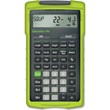
CHCNav LandStar 8 Land Surveying and Mapping App/Software
CHCNavOriginal price $790.00 - Original price $790.00Original price List Price:$790.00$790.00 - $790.00Current price $790.00- Android Compatible: Runs on Android 6.0.1+ and CHCNav field controllers like LT700 and HCE600.
- Survey-Ready Tools: Supports construction layout, control point measurements, GIS data collection, and more.
- MetaCAD™ Engine: Opens large DWG/DXF CAD files in seconds with smooth rendering.
- Cloud Connectivity: Enables project backup, real-time collaboration, and remote support.
- Modular Interface: Customizable layout lets users hide unused tools for a streamlined experience.
- Visual Stakeout: Includes point, line, and CAD-based stakeout with real-time AR-style guidance.
- COGO & Site Calibration: Built-in tools for grid-to-ground, inverse, earthwork, and easy site calibration.
- QR Code Project Transfer: Instantly share settings and projects between controllers with a simple scan.
- Multilingual Support: Includes voice prompts and interface options in over 25 languages.
- Seamless GNSS Integration: Fully compatible with CHCNav GNSS receivers and total stations.
- Standard File Support: Handles RTCM, NMEA, RINEX, and other industry formats for easy import/export.
Original price $790.00 - Original price $790.00Original price List Price:$790.00$790.00 - $790.00Current price $790.00 -

CHCNav TD73 3D Automatic Control System for Dozers
CHCNavOriginal price $33,000.00 - Original price $33,000.00Original price List Price:$33,000.00$33,000.00 - $33,000.00Current price $33,000.00Original price $33,000.00 - Original price $33,000.00Original price List Price:$33,000.00$33,000.00 - $33,000.00Current price $33,000.00 -


CHCNav TD63 Pro 3D Automatic Control System for Dozers
CHCNavOriginal price $22,935.00 - Original price $22,935.00Original price List Price:$22,935.00$22,935.00 - $22,935.00Current price $22,935.00- System Type: Automatic 3D dozer control with hydraulic blade automation
- Positioning: Dual GNSS + IMU (100 Hz)
- Accuracy: ±2 cm (DO-Tech algorithm)
- Horizontal Accuracy (RTK): 10 mm + 1 ppm RMS
- Vertical Accuracy (RTK): 15 mm + 1 ppm RMS
-
Display (Tablet):
- Screen: 10.1″, 1024 × 600 px, 750 cd/m² sunlight readable
- Operating System: Android 6.0.1, 4-core 1.5 GHz CPU, 2 GB RAM + 16 GB ROM
- Ingress Protection: IP65
- Operating Temperature: -4°F to 158°F (−20°C to +70°C)
- Size/Weight: 3.30 lbs.
-
GNSS Receiver:
- Full constellations: GPS, GLONASS, Galileo, BeiDou, QZSS
- RTK Accuracy: H: 10 mm + 1 ppm RMS; V: 15 mm + 1 ppm RMS
- Ingress: IP65
- Operating Temperature: -13°F to +167°F (−25°C to +75°C)
- Weight: 4.40 lbs.
-
GNSS Antenna:
- Gain: 40 ± 2 dB
- Noise Coefficient: ≤ 2 dB
- Shock: 50 g/ 6 ms
- Vibration: 5 grms (2–250 Hz)
- Ingress: IP68
- Operating Temperature: -4°F to 158°F (−20°C to +70°C)
-
IMU Sensor:
- Accuracy: Dynamic: ±0.3° ; Static: ±0.1°
- Shock: 50 g/6 ms
- Vibration: 5 grms (10–400 Hz)
- Ingress: IP67
- Operating Temperature: -40°F to 185°F (−40°C to +85°C)
Original price $22,935.00 - Original price $22,935.00Original price List Price:$22,935.00$22,935.00 - $22,935.00Current price $22,935.00 -


CHCNav MCNAV TX73 3D Guidance System for Excavators
CHCNavOriginal price $21,000.00 - Original price $33,000.00Original price List Price:$21,000.00 - $33,000.00$21,000.00 - $33,000.00Current price $21,000.00- System Type: 3D excavator guidance with real-time RTK and IMU integration
- GNSS Constellations: GPS, GLONASS, BeiDou, Galileo, QZSS
- Supported File Formats: *.LandXML, *.DWG, *.DXF, *.CAL, *.JXL, *.LOC
- Cloud Platform: iSite (remote data sync, troubleshooting, OTA updates)
-
Receiver (CHCNav MC300)
- RTK Accuracy: H: 8 mm + 1 ppm RMS; V: 15 mm + 1 ppm RMS
- Ingress Protection: IP67
- Operating Temperature: -22°F to 149°F (-30°C to +65°C)
- Weight: 2.45 lbs.
-
Display (MCPad300)
- Screen: 10.1″ touch screen (1920 × 1200 px)
- Operating System: Android 14, 8-core CPU up to 2.2 GHz, 6 GB RAM + 64 GB storage
- Ingress Protection: IP67
- Operating Temperature: -22°F to 140°F (-30°C to +60°C)
- Power: 7–36 V DC input
- Weight: 3.30 lbs.
-
IMU Sensor (IS300)
- RMS Accuracy: Dynamic ±0.1°, Static ±0.05°
- Shock: 50G/ 11 ms
- Ingress Protection: IP69K
- Operating Temperature: −40°F to +167°F (−40°C to +75°C)
-
GNSS Antenna (AT315)
- Ingress Protection: IP68
- Gain: 40 ± 2 dB
- Noise: ≤2 dB
- Shock: 40G/ 11 ms
- Operating Temperature: −40°F to +167°F (−40°C to +75°C)
Original price $21,000.00 - Original price $33,000.00Original price List Price:$21,000.00 - $33,000.00$21,000.00 - $33,000.00Current price $21,000.00 -


CHCNav EasyNav EMG100 3D Excavator System
CHCNavOriginal price $13,000.00 - Original price $13,000.00Original price List Price:$13,000.00$13,000.00 - $13,000.00Current price $13,000.00- System Type: 3D excavator guidance with in-field surface design
- GNSS Constellations: GPS, GLONASS, BeiDou, Galileo, QZSS; L-Band support
- Accuracy: Centimeter-level (RTK), real-time cut/fill volume display
- Machine Compatibility: Swivel/offset/triple booms; multiple bucket profiles; tilt bucket support (optional IMU)
-
Display:
- Screen: 10.1", 1024 × 600, ~750 cd/m²
- OS/CPU/Memory: Android 6; Quad-core 1.2 GHz; 2 GB RAM / 16 GB ROM
- Ingress/Vibration/Shock: IP69K; 7.7 Grms (10–1000 Hz); 50 g / 11 ms
- Power: 7–36 V DC input
- Ingress Protection: IP65
- Operating Temperature: -22°F to +158°F (−30°C to +70°C)
- Weight: 3.31 lbs.
-
GNSS Antenna:
- Gain / Noise Figure: 40 ± 2 dB
- Shock: 50 g / 11 ms
- Ingress: IP68
- Power: 3.3–12 V DC
- Vibration: MIL-STD-810H, 7.7 G
- Operating Temperature: -40°F to +185°F (−40°C to +85°C)
-
IMU Sensor:
- Dimensions: 48.9 × 109 × 27.3 mm
- Accuracy (RMS): Static ±0.05°, Dynamic ±0.1°
- Shock: 50 g / 11 ms
- Ingress: IP69K
- Operating Temperature: -40°F to +167°F (−40°C to +75°C)
- Weight: 0.25 lbs.
Original price $13,000.00 - Original price $13,000.00Original price List Price:$13,000.00$13,000.00 - $13,000.00Current price $13,000.00 -
CHCNav CGO GNSS Post-Processing Software
CHCNavOriginal price $0.00 - Original price $0.00Original price List Price:$0.00$0.00 - $0.00Current price $0.00- Flexible Deployment: Compatible with Windows 7/8/10 (32/64-bit)
- Multi-Mode Processing: Supports static, fast static, PPK, and PPP algorithms for GNSS accuracy
- UAV & Road Support: Handles UAV trajectories, GCPs, and road design-based stakeout projects
- Wide Format Support: Import/export RINEX, SHP, DXF, KML, CSV, PDF, TXT, and more
- Geodetic Tools: Includes coordinate converters, map compressors, antenna manager, and COGO tools
- Real-Time Map Integration: Connects to OSM, Google, Bing, WMS, and WMTS for base map views
- Data Quality Check: Automated quality control and report generation for stations, baselines, and loops
- Massive Data Handling: Efficiently processes large GNSS survey datasets and UAV flight logs
Original price $0.00 - Original price $0.00Original price List Price:$0.00$0.00 - $0.00Current price $0.00Sold out -
CHCNav MapCloud Advanced GIS Data Collection and Mapping App/Software
CHCNavOriginal price $0.00 - Original price $0.00Original price List Price:$0.00$0.00 - $0.00Current price $0.00- Android-Compatible: Runs on Android 7.0.1+ tablets and CHCNav data controllers (LT800, LT60H, HCE600)
- Broad Format Support: Handles SHP, DXF, DWG, KML, TIFF, GPX, WMS/WFS, and more
- Accurate Data Capture: Connects to CHCNav GNSS receivers for high-precision mapping
- Custom Layer Templates: Industry-specific templates and simultaneous multi-feature capture
- Cloud-Based Sync: Integrated Sharing Code feature for easy project sharing and collaboration
- Powerful Mapping Engine: Efficiently processes GB-grade SHP and TB-grade TIFF files
- Coordinate Tools: Includes track recording, coordinate stakeout, length/area measurements
- Thematic Mapping: Label and classify complex data with thematic maps and attribute libraries
- Voice Prompts & Tutorials: Field-ready UX with voice guidance and embedded video help
- Multilingual Support: Available in 25+ languages
- Real-Time Base Maps: Supports Google, Bing, WMS, and WFS for background reference
Original price $0.00 - Original price $0.00Original price List Price:$0.00$0.00 - $0.00Current price $0.00Sold out


About CHCNav
Founded in 2003, CHC Navigation (CHCNav) designs, manufactures, and delivers precision geospatial solutions to professionals across the construction, surveying, and mapping industries. With a presence in over 120 countries, CHCNav is trusted globally for its commitment to accuracy, performance, and value.
At Tiger Supplies, we offer a select lineup of CHCNav GNSS receivers, known for their advanced IMU-RTK capabilities, robust build quality, and seamless connectivity. Whether you're managing large-scale construction projects or high-precision surveys, CHCNav GNSS systems provide the reliability and efficiency professionals demand in the field.