Skip to content
CALL OUR SALES EXPERTS TODAY: [984-664-9260] Habla Espanol [504-383-7978]

Your Cart (0)

View cart

Your cart is empty

Continue shopping

Surveying Equipment

All Surveying Equipment Categories

Best Sellers
  • Original price $1,125.00 - Original price $1,125.00
    Original price List Price:
    $1,125.00
    $1,125.00 - $1,125.00
    Current price $1,125.00

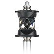
    ZPR1 360 Prism

    Geomax
    • Accuracy of up to 0.07 inches (2 mm)
    • Protected by top and bottom rubber pads
    • Complete coverage from any angle
    • Safe storage with the included soft case 
    View full details
    Original price $1,125.00 - Original price $1,125.00
    Original price List Price:
    $1,125.00
    $1,125.00 - $1,125.00
    Current price $1,125.00
  • Original price $1,251.64 - Original price $1,251.64
    Original price List Price:
    $1,251.64
    $1,251.64 - $1,251.64
    Current price $1,251.64

    Nedo Industrial Line Shaft Aluminum Survey Tripod - 210710

    Nedo
    • Mount 3D scanner on top or at the bottom of the column
    • Lifts up to 16 ft.
    • Shaft depth of up to 13 ft.
    • Twist-proof elevating column
    • Hand crank with magnetic bit holder
    • Cordless screwdriver
    • Four 1m rack elements
    • All-terrain use
    View full details
    Original price $1,251.64 - Original price $1,251.64
    Original price List Price:
    $1,251.64
    $1,251.64 - $1,251.64
    Current price $1,251.64
  • Original price List Price: $4,950.00
    You Save: $333.00 -7%
    Original price $4,950.00 - Original price $4,950.00
    Original price List Price: $4,950.00
    Current price $4,617.00
    $4,617.00 - $4,617.00
    Current price $4,617.00

    GeoMax ZOOM10 Manual Total Station - 876826

    Geomax
    • Android device compatibility 
    • Simple and convenient data collecting 
    • Fast tracks workflow 
    • Amazing capabilities for an entry-level total station 
    • Excellent price point  
    • Hexagon quality assurance
    View full details
    Original price List Price: $4,950.00
    You Save: $333.00 -7%
    Original price $4,950.00 - Original price $4,950.00
    Original price List Price: $4,950.00
    Current price $4,617.00
    $4,617.00 - $4,617.00
    Current price $4,617.00
    Save 7% Save %
  • Original price $467.48 - Original price $467.48
    Original price List Price:
    $467.48
    $467.48 - $467.48
    Current price $467.48

    Nedo Extra Heavy-Duty Elevating Aluminum Survey Tripod - 210683-185

    Nedo
    • Adjustable height: 33 to 119 inches
    • Perfect for rotating lasers & 3D laser scanners
    • Leg struts & brass hinge pins for stability
    • Combi feet for all-terrain use
    • Two-fold, telescoping aluminum legs 
    • Center column elevates up to 23 inches
    • Aluminum head with 5/8-11 threading
    • Break-proof quick-release levers
    View full details
    Original price $467.48 - Original price $467.48
    Original price List Price:
    $467.48
    $467.48 - $467.48
    Current price $467.48
  • Original price $165.00 - Original price $165.00
    Original price List Price:
    $165.00
    $165.00 - $165.00
    Current price $165.00

    NAT96 Aluminum Elevator Survey Tripod

    Northwest Instrument
    • Adjustable height: 46 to 108 inches
    • Weight capacity of up to 39 lbs.
    • Center column elevates up to 9 feet
    • Rotating top plate head with 5/8-11 thread
    • Gear-driven bottom half
    • Manually-adjustable top half
    • Quick-release clamp
    • Steel pointed feet
    View full details
    Original price $165.00 - Original price $165.00
    Original price List Price:
    $165.00
    $165.00 - $165.00
    Current price $165.00
  • Original price $355.00 - Original price $355.00
    Original price List Price:
    $355.00
    $355.00 - $355.00
    Current price $355.00

    CET103 Elevating Aluminum Survey Tripod with Hand Crank

    Leica
    • Adjustable height: 2.75 to 8 feet
    • Medium-duty aluminum construction
    • Elevating center column for extra height
    • 12-inch crank with mm scale
    • Quick-release clamp locking system
    • Built-in bubble level for aligning
    • Pointed and removable rubber feet
    • Ideal for laser levels such as Leica Roteo lasers
    View full details
    Original price $355.00 - Original price $355.00
    Original price List Price:
    $355.00
    $355.00 - $355.00
    Current price $355.00
  • Original price $141.64 - Original price $141.64
    Original price List Price:
    $141.64
    $141.64 - $141.64
    Current price $141.64

    62 mm Copper-Coated Prism

    Seco
    Original price $141.64 - Original price $141.64
    Original price List Price:
    $141.64
    $141.64 - $141.64
    Current price $141.64
  • Original price $220.05 - Original price $220.05
    Original price List Price:
    $220.05
    $220.05 - $220.05
    Current price $220.05

    2.5 inch Sliding Prism with Tilting Reflector

    Seco
    • Large 2.5-inch (63.5 mm) silver-coated prism with protective rubber ring
    • 0 (zero) offset
    • Attaches to the bottom of the graduated section of the pole so heights can be taken close to the ground
    • Large easy-to-use clamping knob
    • Tilts in 15º increments, spring locked
    • 40-minute leveling vial
    • Target is made of fluorescent-yellow translucent polycarbonate
    View full details
    Original price $220.05 - Original price $220.05
    Original price List Price:
    $220.05
    $220.05 - $220.05
    Current price $220.05
  • Original price List Price: $1,575.00
    You Save: $425.00 -27%
    Original price $1,575.00 - Original price $1,575.00
    Original price List Price: $1,575.00
    Current price $1,150.00
    $1,150.00 - $1,150.00
    Current price $1,150.00

    Digital Electronic Theodolite (2-Second) - DET-2

    Spectra Geospatial
    • Angular accuracy of 2-sec 
    • Magnification up to 30x 
    • Wide aperture of 1.8” 
    • Backlit LCD display with 6-button keypad 
    • Audible 90-deg beep for faster orientation 
    • IP54 dustproof and water spray resistant 
    View full details
    Original price List Price: $1,575.00
    You Save: $425.00 -27%
    Original price $1,575.00 - Original price $1,575.00
    Original price List Price: $1,575.00
    Current price $1,150.00
    $1,150.00 - $1,150.00
    Current price $1,150.00
    Save 27% Save %
  • Original price $1,086.80 - Original price $1,086.80
    Original price List Price:
    $1,086.80
    $1,086.80 - $1,086.80
    Current price $1,086.80

    NETH503 5" Digital Transit-Theodolite (5 Second Accuracy)

    Northwest Instrument
    • Angular accuracy of 5-sec 
    • Magnification up to 30x 
    • Advanced?glass encoder 
    • Reticle?illumination 
    • Dual?LCD display 
    • Battery?life up to 40 hours 
    View full details
    Original price $1,086.80 - Original price $1,086.80
    Original price List Price:
    $1,086.80
    $1,086.80 - $1,086.80
    Current price $1,086.80
  • About Surveying Equipment
    About Surveying Equipment

    Survey Equipment: A Complete Guide for Land Surveyors

    Survey equipment is the backbone of accurate land surveying, enabling professionals to measure, map, and analyze the environment with precision. From boundary surveys to topographical mapping, reliable surveying instruments and supplies ensure every project is completed efficiently and accurately. This guide explores essential tools, their uses, and tips for choosing the right equipment.

    What Is Survey Equipment?

    Survey equipment refers to the instruments, tools, and supplies land surveyors use to measure angles, distances, and elevations. These tools are indispensable in construction, land development, and engineering projects, where precise measurements are critical. They range from traditional land surveying equipment like theodolites to advanced electronic distance meters (EDMs), GNSS receivers, and integrated surveying software.

    Jobs That Require Survey Equipment
    Surveying equipment is essential across a variety of industries and projects, including:

    • Boundary Surveys: Establish legal property lines and ensure compliance with regulations.
    • Topographical Surveys: Create detailed maps of land features for planning and development.
    • Site Surveys: Prepare construction sites by mapping and grading the area.
    • Road Construction: Align and grade roadways to meet design specifications.
    • Utility Mapping: Locate and document underground utilities to prevent damage during excavation.

    Tip: For large-scale projects requiring high accuracy, consider survey-grade GPS tools or advanced GNSS receivers for optimal results.

    Essential Survey Equipment and Their Uses

    Land Survey Equipment and Surveying Supplies encompass a broad array of products, from advanced robotic total stations and GPS receivers with pinpoint satellite accuracy to total stationstheodolitesdata collectorselectronic levels, and range finders.

    Not only can you measure, collect, calculate and interpret data in the field, but you can also transfer this data to your computer using the right land surveying equipment. There are also many different kinds of optical levels to complement your surveying equipment and tasks. Tiger Supplies carries all types of land survey equipment as well as accessories, such as prismstripodssurveying rods, and more.

    Total Stations

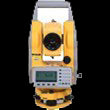
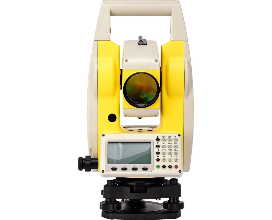
    Total stations are indispensable tools that combine the capabilities of theodolites and electronic distance meters (EDMs). They allow surveyors to measure both angles and distances with exceptional accuracy, making them ideal for tasks like boundary surveys, construction site layouts, and infrastructure planning. Many modern total stations come equipped with integrated surveying software for data collection and transfer, streamlining workflows and improving productivity.

    Our diverse selection of total stations includes manual and robotic total stations, reflectorless and non-reflectorless total stations, and total station accessories including top-quality prismsprism polestribrachs, and even data storage options.

    Theodolites

    Theodolites, such as the Spectra theodolite or Leica theodolite, are precision instruments used to measure horizontal and vertical angles. These tools are essential for aligning structures, mapping terrain during topographical surveys, and designing roads and railways. Digital theodolites provide enhanced accuracy and usability, reducing errors in detailed surveying tasks.

    Automatic Levels

    Automatic levels, or auto levels, are critical for determining height differences and ensuring that structures and surfaces are level. Whether used for grading roads, leveling foundations, or conducting elevation surveys, these instruments are valued for their simplicity and precision. Models like the Bosch auto level are particularly popular for their reliability in challenging conditions.

    GNSS/GPS Receivers

    GNSS (Global Navigation Satellite System) receivers, also known as survey-grade GPS devices, capture geospatial data with pinpoint accuracy. These tools are invaluable for large-scale mapping projects, such as urban planning, infrastructure development, and topographical surveys in remote or expansive areas. Their portability and efficiency make them indispensable for modern land surveyors.

    At Tiger Supplies, we also provide GNSS accessories including  GPS rover rods,  communication radios,  GNSS processing software, and much more.

    Electronic Distance Meters (EDMs)

    EDMs measure distances electronically using laser or infrared technology. Often integrated into total stations, they provide a fast and highly accurate alternative to traditional measuring tapes. EDMs are ideal for boundary and site surveys, as well as for verifying critical measurements in construction layouts.

    Survey Tripods and Mounts

    Survey tripods stabilize instruments like total stations, theodolites, and auto levels. Their durable, adjustable designs ensure consistent accuracy, even on uneven terrain or in windy conditions. Find the ideal survey tripod with our collection of affordable and quality wooden, fiberglass, and aluminum tripods, non-elevating and elevating tripods, and fixed and height-adjustable tripods.

    Field Supplies

    Field supplies, including field books, stake flags, flagging tapes, plumb bobs, target and reflective sheets, aerial targets are essential surveying field supplies that builders, engineers, contractors, and surveyors can possibly need. These tools help keep surveys organized and efficient, ensuring seamless on-site workflows.

    Reflector Targets and Prism Systems

    Prism systems extend the range of total stations by reflecting signals for precise distance measurements. They are widely used in structural monitoring, detailed construction surveys, and topographical mapping projects.

    Measuring Wheels

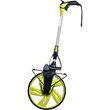
    Measuring wheels, often called surveyor’s wheels, are practical tools for estimating distances. They perform well on uneven terrain and are ideal for preliminary measurements or construction planning.

    How to Choose the Right Survey Equipment

    Selecting the right survey equipment is essential for efficiency and accuracy. Consider these factors:
    1. Nature of the Project: plays a key role in determining the most suitable survey equipment. For boundary surveys, tools like total stations or theodolites are ideal as they provide precise angle and distance measurements necessary for establishing accurate property lines. Topographical surveys, which require detailed mapping of land features, benefit greatly from the use of GNSS receivers and total stations due to their ability to capture geospatial data with high precision. For construction layouts, equipment such as auto levels, laser levels, and sturdy tripods are essential to ensure precise leveling and alignment, making them indispensable for grading, foundation work, and overall site preparation. Selecting the right tools tailored to your specific project needs is crucial for achieving efficient and accurate results.
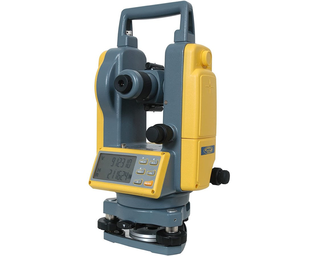
    2. Required Accuracy: Different projects demand varying levels of precision. High-stakes tasks like infrastructure design demand digital theodolites and survey-grade GPS for precise results.
    3. Budget: Surveying equipment varies widely in cost. Basic tools like measuring wheels are affordable, while advanced instruments like GNSS receivers are larger investments. Quality equipment ensures long-term reliability.
    4. Durability: Outdoor projects often require weather-resistant and rugged equipment. Check for features like water resistance, shockproof design, and material durability.
    5. Compatibility and Technology: Ensure the equipment is compatible with software used for data analysis. Modern surveying tools often integrate with cloud-based systems for easier data sharing and reporting

    Why Quality Survey Equipment Matters

    Investing in high-quality survey equipment ensures:

    • Accurate Data Collection: Reduce errors and improve project outcomes.
    • Long-Term Reliability: Durable tools withstand harsh environments and frequent use.
    • Improved Productivity: Advanced features like GNSS and EDM technology streamline workflows.

    Tip: Prioritize tools that align with your project’s needs and long-term goals to maximize efficiency and accuracy.

    FAQs About Survey Equipment

    Q: What surveying tools are best for beginners?
    A: For beginners, simple tools like auto levels, measuring wheels, and basic theodolites are a great starting point. As you gain experience, more advanced tools like total stations and GNSS receivers can be added to your toolkit.

    Q: What is the most common tool used by land surveyors?
    A: Total stations are widely used due to their ability to measure angles and distances with precision.

    Q: What is the cost of survey equipment?
    A: The cost of survey equipment ranges widely. Basic tools like measuring wheels and field books are affordable, while advanced instruments like total stations and GNSS receivers can cost several thousand dollars. Investing in quality ensures long-term reliability.

    Q: What should I look for when buying survey equipment?
    A: Consider factors like the project type, required accuracy, budget, and durability to make an informed decision.

    Q: What is the lifespan of survey equipment?
    A: The lifespan varies depending on the type of equipment, usage, and maintenance. High-quality instruments like total stations and GNSS receivers can last 10–15 years or more with proper care and regular calibration. Accessories like measuring wheels or stake flags may need more frequent replacement.

    Q: How should I take care of survey equipment?
    A: Proper care includes:

    • Cleaning equipment after use to remove dust and debris.
    • Storing instruments in protective cases when not in use.
    • Scheduling regular calibration to maintain accuracy.
    • Avoiding exposure to extreme weather unless the equipment is rated for such conditions.

    Q: How often should survey equipment be calibrated?
    A: Calibration frequency depends on usage and the type of equipment. Generally, instruments like total stations and GNSS receivers should be calibrated at least once a year or whenever there’s a noticeable change in accuracy.

    Q: What are the best practices for storing survey equipment?
    A: Store equipment in protective, padded cases to prevent damage. Keep them in a dry, temperature-controlled environment to avoid issues caused by moisture or extreme temperatures. Always clean equipment before storage to remove dirt and debris.

    Q: Can survey equipment be used in bad weather?
    A: Many modern survey instruments, like GNSS receivers and total stations, are designed to be weather-resistant. However, extreme weather conditions (e.g., heavy rain or snow) can still impact accuracy and equipment functionality. Always check the manufacturer's specifications for weather resistance.

    Q: Are digital theodolites better than traditional theodolites?
    A: Digital theodolites offer improved accuracy, easier data reading, and reduced manual errors compared to traditional theodolites. They are preferred for high-precision projects like road design and structural alignment.

    Q: What is the difference between a total station and a theodolite?
    A: While both measure angles, a total station combines angle measurements with electronic distance measurement (EDM) capabilities. This makes it more versatile for tasks like boundary surveys and construction layouts, while theodolites are typically used for angle measurements alone.

    Q: How do I choose between GNSS receivers and total stations?
    A: GNSS receivers are ideal for large-scale mapping projects and topographical surveys requiring geospatial data over expansive areas. Total stations, on the other hand, are better suited for tasks requiring high-precision angle and distance measurements in smaller, more defined areas like construction sites or property boundaries.

    Q: How does an electronic distance meter work?
    A: Electronic distance meters use lasers or infrared signals to measure distancesquickly and accurately, often integrated into total stations.

    Ready to Elevate Your Surveying Projects?

    Whether you’re conducting a boundary survey, topographical mapping, or a construction site layout, having the right equipment is crucial. Equip yourself with industry-leading total stations, GNSS receivers, and precision instruments designed for reliability and accuracy.

    Need help finding the right tools?
    Tiger Supplies' team of experts is here to guide you. Contact us today to explore the best survey equipment for your next project and ensure every measurement meets your expectations.

    Compare products

    {"one"=>"Select 2 or 3 items to compare", "other"=>"{{ count }} of 3 items selected"}

    Select first item to compare

    Select second item to compare

    Select third item to compare

    Compare