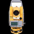
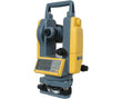
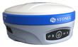
Benchmark Supply i83 and i89 Base & Rover Surveying Package | i83-i89-BRSV
Store Pickup: List of available stores available on the Checkout page.
The cart will thereforce automatically set Qty to 1 when you order this product
Store Pickup: List of available stores available on the Checkout page.
The cart will thereforce automatically set Qty to 1 when you order this product
GNSS Performance
UHF Radio Communication
Power & Battery
Ingress Protection/Durability
The Benchmark Supply's i83 and i89 Base & Rover Surveying Package combines two high-performance GNSS receivers in a versatile setup designed for demanding field applications. With advanced satellite tracking, long battery life, and robust connectivity, this package is ideal for topographic surveys, construction layout, excavation control, and mining operation survey.
Both the i83 and i89 receivers are equipped with 1408 channels and iStar 2.0 technology, enabling full multi-constellation tracking across GPS, GLONASS, Galileo, BeiDou, QZSS, and IRNSS systems. This ensures faster satellite acquisition and higher positioning reliability even in challenging environments.
The i89 GNSS rover brings together lightweight construction, advanced iStar 2.0 technology for superior ionospheric error mitigation, and a 200Hz Auto-IMU with tilt compensation up to 60°—allowing efficient stakeouts in challenging terrain. It’s also equipped with dual cameras for visual surveying, ideal for capturing high-accuracy data and site photos on the go.
The i89 rover includes cutting-edge features such as dual cameras for augmented field data capture, iStar 2.0 ionospheric error mitigation, and a 200Hz IMU module for real-time tilt compensation up to 60°. Whether working near buildings, fences, or uneven terrain, the i89 ensures precision without the need for vertical pole alignment.
The included one-year subscription of Control Point Corrections TrueRTK (powered by Point One Navigation) provides centimeter-level accuracy with 99% uptime and an active5 8-inch tablet is powered by Android and comes pre-installed with LandStar 8 software, offering a modern, map-centric interface for data collection, COGO, CAD integration, and surface modeling. Field-ready accessories are also included to ensure seamless setup and reliable use in all survey conditions.
{"one"=>"Select 2 or 3 items to compare", "other"=>"{{ count }} of 3 items selected"}